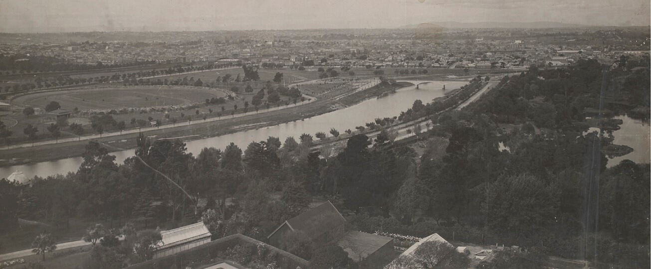
The lower Yarra today is largely ‘man-made’ – very different from its natural course. From near the Royal Botanic Gardens to the Bay, the river now flows almost entirely through an artificial channel.
The Yarra in flood
Narrow and shallow, the Yarra was prone to flooding. The first flood recorded was in December 1839, when the Yarra burst its banks after three days of rain. What is now Southbank was submerged under about three metres of water. Settler William M’Haffie recalled rowing from the Customs House in Flinders Street across South and Port Melbourne to the beach.
The flood in 1863 was worse. Melbourne recorded nearly 140mm of rain in five days.
Floodwater, that 40 years earlier would have spread harmlessly across a vast plain, swamped businesses and residents in low-lying, mostly poor areas, adjacent to the river. In the next big flood in 1891, 3,000 people were made homeless.
The Argus reported: ‘From Princes Bridge for several miles upwards the Yarra resembled an inland lake. In Richmond in many streets only the tops of houses were visible.’
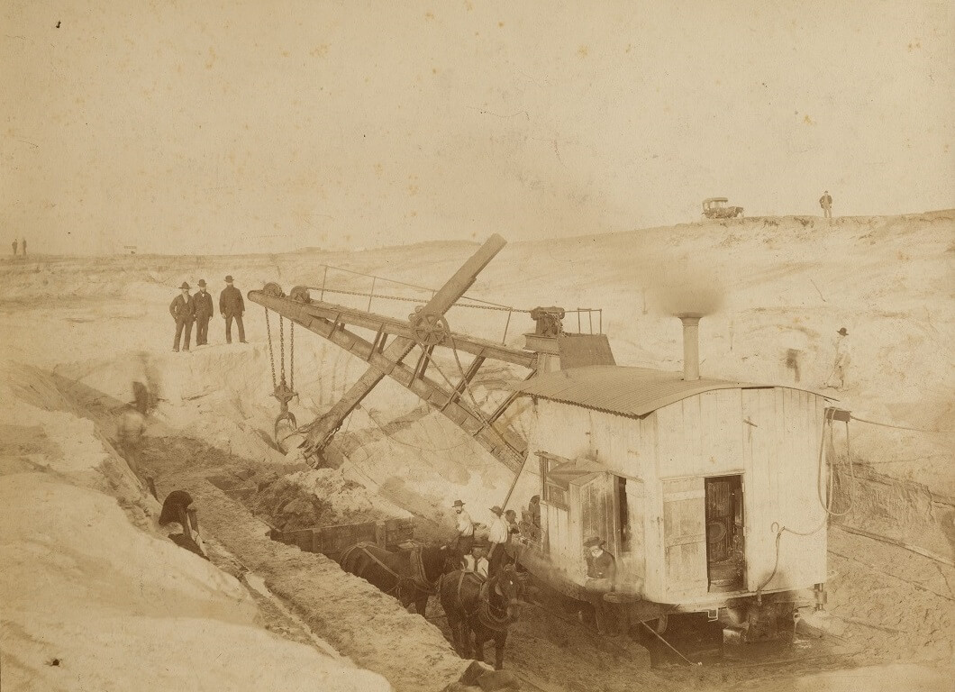
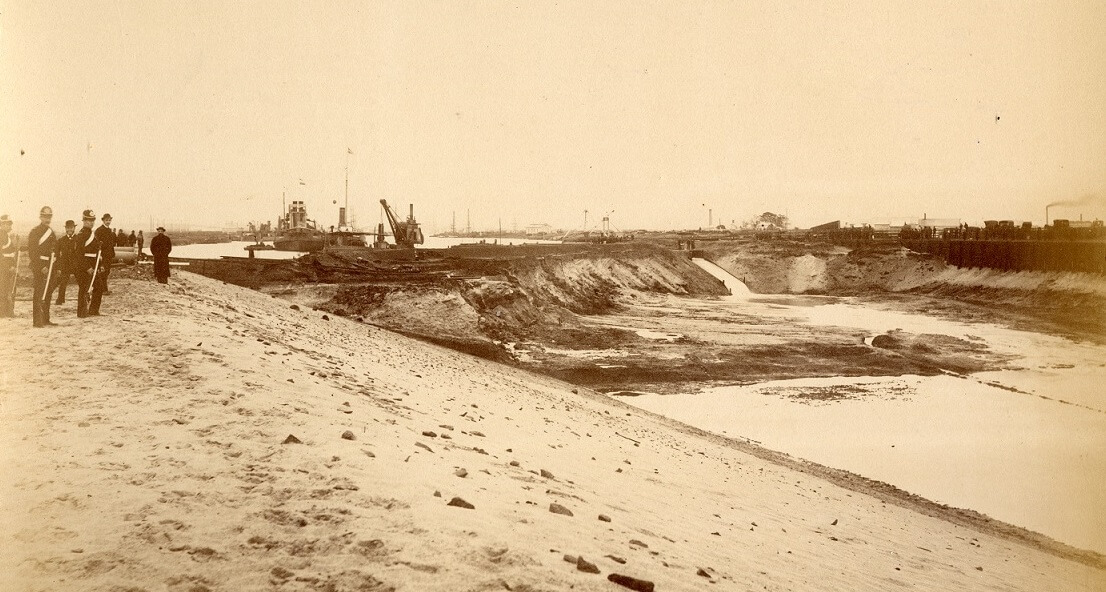
Construction of the Coode Canal.
Reproduced courtesy Public Record Office Victoria. VPRS 8357, P3, Unit 2, Photo 32.
Coode Canal opened in 1886. Dug by steam shovel and by hand, the new canal was 2,000 metres long, 130 metres wide and 6 metres deep at low tide. It was a major engineering feat.
Preventing the floods
By the 1880s major engineering works were underway to ‘tame the river’, reducing the effects of flooding. The Yarra was widened, deepened and shortened to move floodwaters to the bay more readily.
Improving access
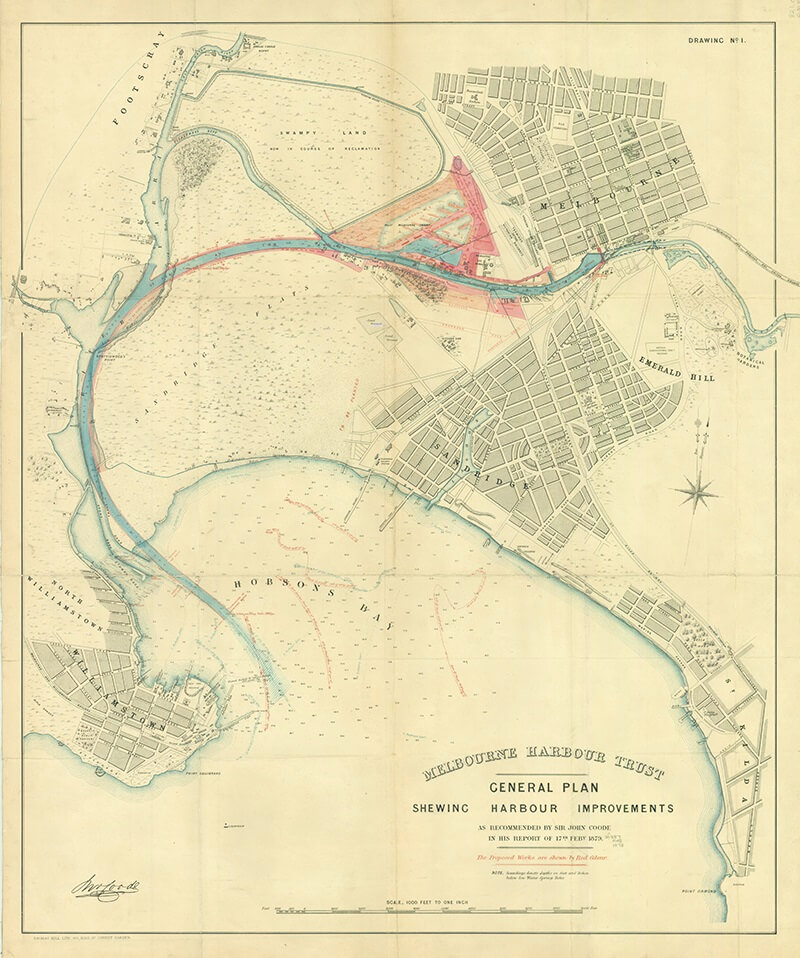
In 1878 the Melbourne Harbour Trust hired a leading engineer from Britain, Sir John Coode, to improve shipping access. He suggested a new course for the Yarra, removing a bend in the river known as Fishermans Bend, and ‘straightening’ the river.
Victoria Dock was also built on the reclaimed site of the West Melbourne Swamp. It enclosed 96 acres of water. Its completion in 1892 initiated the downstream migration of the wharves and docks to Hobsons Bay.
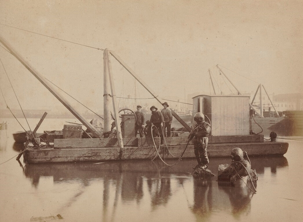
Divers removing Falls Reef, Yarra River, by J. W. Lindt, photographer, c.1883-85
Reproduced courtesy National Library of Australia.
The ‘Falls’ were removed with explosives from 1883 making way for Queens Bridge.
Sir John Coode’s plan for the Port of Melbourne, 1879. An unknown hand has coloured in the planned alteration to the course of the river and the proposed docks.
Reproduced courtesy State Library Victoria
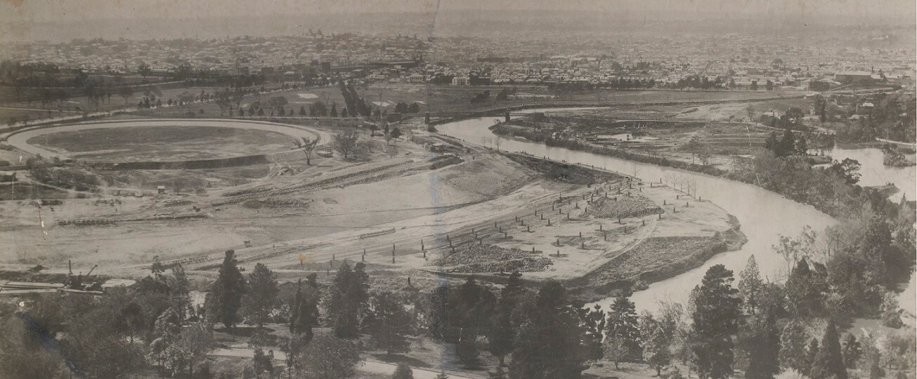
The Yarra Improvement Act 1896 enabled the Board of Land and Works to undertake major realignments between Princes Bridge and Church Street, changing the course of the Yarra.
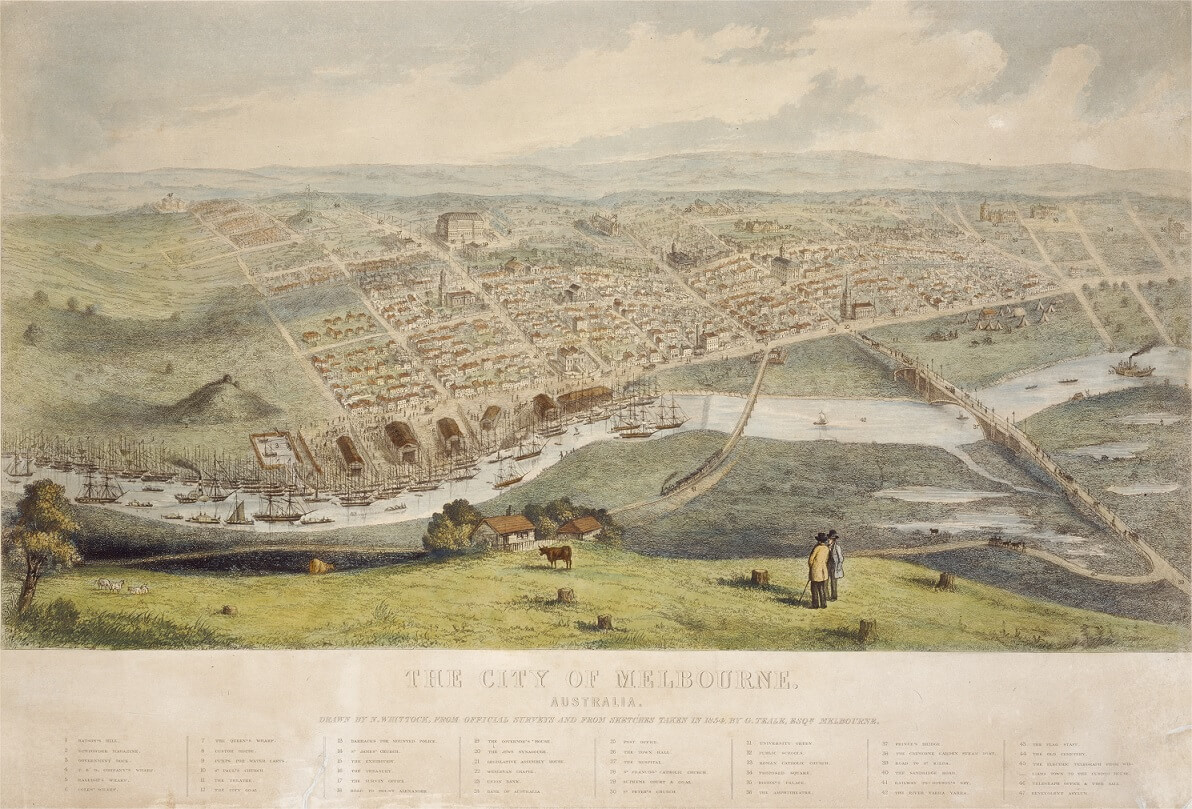
The City of Melbourne, Australia, by N.Whittock, 1855
Reproduced courtesy State Library Victoria
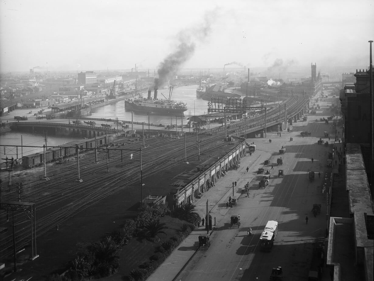
Flinders Street looking west to Queens Bridge, by Kerr Brothers, photographers, c.1920
Reproduced courtesy State Library Victoria
Downstream from Queens Bridge was the Turning Basin, or ‘Pool of Melbourne’. This basin was widened and deepened progressively to allow bigger ships to turn or moor.
Water was let into the Fishermans Bend Cut in 1886, close to the current site of the Bolte Bridge.
Reproduced courtesy Public Record Office Victoria. VPRS 8355, P1, Image 3.

